ROAD DESIGN
Detailed Engineering and Design
|
|
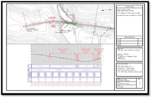
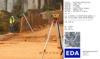
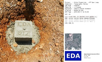
The use of GPS survey equipment allows for rapid and accurate surveys during establishment of controls and project execution. We upload the data collected from robotic total stations directly into the computer, and quickly develop alternative design solutions during feasibility studies and preliminary engineering phases. EDA has embraced the use of CADD software for road design that allows us to refine the design, estimate quantities, and finalize the plan sheets in a relatively short period of time.
Adapting to Changes in Technology
|
Roadway Design
EDA uses the latest road design software to do roadway and site design, estimate quantities, and prepare bid documents.
Civil3D 2018 AutoCAD 2018 ArcGIS |
|
Engineering Design
EDA uses civil engineering software for deep and shallow foundation design, and hydrologic analyses.
Autodesk Bridge Design AllPile Custom Spreadsheets |
|
Project Operations
EDA uses office support software to prepare reports, perform analyses, and manage operation.
MS Excel MS Word MS Power Point |
|
Document Production
EDA has desktops, laptops, printers and a local administrative team for plan and report production
|
